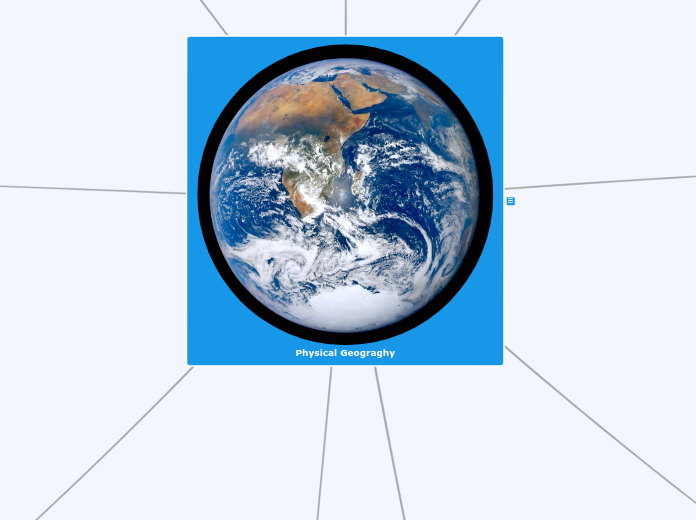
Physical Geograghy
Physical Geography is one of the main discussion topics in Geography, it deals with the physical aspect and characteristics of the Earth. Includes, landforms, bodies of water, climate, soil, flora and fauna.

Geologic History
Geologic History:Is the use of principles or techniques to learn about the Earth's history. (What was it like during different time periods on Earth, and how have humans changed it.)
Eras'
ErasAll the major periods in time are categorized into different eras based on, specific events that took place within a certain time period.There's 4 main eras in geologic time: (chronological order)1) Per cambrian2) Paleozoic3) Mesozoic4) Cenozoic
Pre cambrian
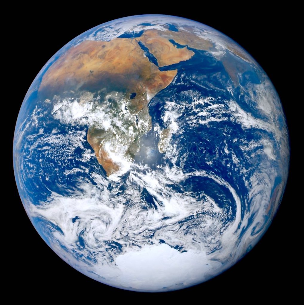
The Pre cambrian era was the term used to describe the time of the earth when there was mostly layers of sedimentary rock, obtaining the Earth's oldest fossils (a giant landmass), and when oxygen also started to accumulate in the atmosphere, resulting in more multicellular organisms starting to form and evolve. This era lasted roughly 4 billion years, taking up around 90% of the Earth's geologic history.
Paleozoic
The Paleozoic era was when the separation of the super continent occurred, and a large portion of the Earth's landmass was covered by water. Contained within these large bodies of water where various marine organisms and invertebrates (animals without a backbone). More marine species formed and evolved throughout the existence of the Paleozoic era; the age of amphibians. A major event that took place during the end of the Paleozoic era was the mass extinction. Era Lasted roughly 542 million years to 251 million years.
Mesozoic
The Mesozoic era was the age of reptiles (dinosaurs) and when birds evolved from dinosaurs. Flowers and different vegetation evolve and formed as well. The formation of the Rocky mountains occurred within this period of time. The Mesozoic era lasted roughly 186 million years.
Cenozoic
During the early stages of the Cenozoic era, there was the mass extinction of dinosaurs, and eventually the evolution of humans occurred, and other mammals formed. This era started 66 million years ago and is the current era.

Glaciation
Definition Of Glaciation:The process and time period of an area being covered in sheets of ice. ( Ice age)Example; the Canadian shield existed before the ice age but after it melted it altered the physical geography of the land. Leaving behind large bodies of water (lakes, river, etc.) and a rugged, rocky landscape.

Sediments
Definition of Sediments:Certain forms of matter that is brought by water and is left behind and usually becomes rock.

Erosion
Definition of Erosion:A gradual process of something being eroded or diminished by wind, water, ice, snow, and other natural events.Example: the Appalachian mountains where formed in the Paleozoic era, making them very old and providing them with enough time to be exposed to the affects of erosion. Instead of being rigged and pointed, like the innuitian mountains. Their physical appearance is more flat and have smoother slopes, and in non urban areas their densely forested.
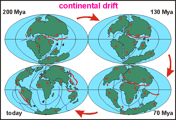
Continental drift
Definition of Continental Drift:The theory of Continental drift discovered by Alfred Wegener, is the gradual motility of land masses (continents) across the Earth's surface, over a certain period of time.

Pangea
Pangea was a super-continent, approximately 335 million years ago, it was the sum of all the continents linked together. But roughly 175 million years ago the continents started to break apart, during the Paleozoic era and early Mesozoic era. Shaping the land masses and locations that they're currently in.Alfred Wegener discovered Pangea, with his theory of continental drift.
Continental drift evidence
People did not believe his theories a that point in time, so Alfred Wegener collected four pieces of evidence that could prove his theory of Continental drift. They include the following:1) The Jigsaw Formation2) Fossil Evidence3) Similar landforms on either side of the Atlantic 4) Ice sheets covering parts Africa, India, and Australia.
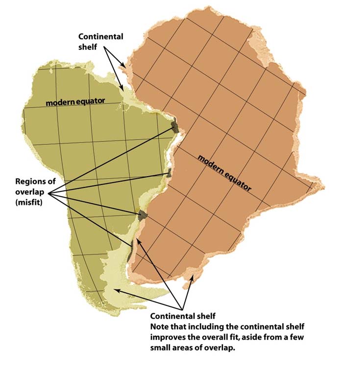
1) Jigsaw Formation
The jigsaw formation is all the continents abilities to fit together like puzzle pieces.
2) Fossil Evidence
When there was one distinct land mass dinosaurs and other organisms were able to travel to other far away areas so, species, and dinosaurs were more spread out among larger areas. So when the continents spilt, specific species of dinosaurs, their fossils or remains could be found on different continents.Example; a triassic land reptile's (Cynognathus) fossil remains were found in South America and Africa.
3) Similar Landforms on either side of the Atlantic
Some continents have similar landforms on both sides of the Atlantic, that were attached to form Pangea, providing them with similar physical features. (same types of rock, in some areas)
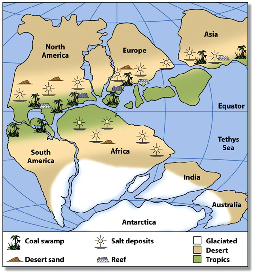
4) Ice sheets covered parts of Africa, India, and Australia
Certain ice sheets covered parts of Australia, Africa, India, and Antartica. However, those areas/continents are primarily split apart so they only only could of had similar ice sheets if they where connected.

Canada's Landforms
A landform region is a part of the Earth, with a unique set of physical features, that people often use to meet their needs.Canada is Divided into 7 different landform regions, they were divided based on how they physically look, how and when they were formed.There are three distinct types of landform regions; Highlands, Lowlands, and shield.
Arctic Lowands
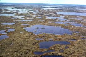
The Arctic lowlands are one of the 7 landform regions, that Canada is divided into. This region is located in northern Quebec, northern Ontario surrounding a small part of the Hudson Bay, covers a large portion of Nunavut and the Northwest Territories. This area is very remote, very few people inhabit the land, due to its cooler climate, poor soil and even though the physical aspect of the land is flat it consists of various wetlands across the region. Theres also a lot of bogs, swamps, marshes, shrubs, and lakes, within or surrounding the Arctic lowlands.Mainly Indigenous communities live throughout the region and they utilize the land for hunting and fishing.
Interior Plains
The Interior Plains cover varying portions of Alberta, Saskatchewan and Manitoba. A large amount is taken up by flat land and some rolling hills. farming is very common, to the extent where its called "Canada's bread basket". An extensive amount of produce, grains, and crops is produced within this region. Mining and farming are the primary economic industries distinct to this area.A few activities, that can be done throughout the region are fishing, hunting, skiing, and skating depending on the season.
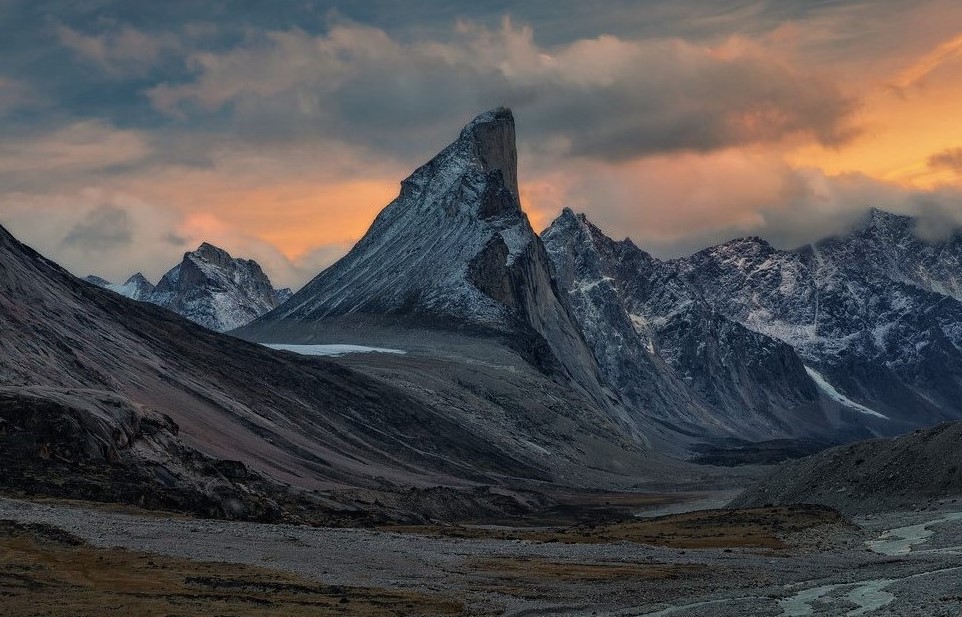
Innuitian Mountains
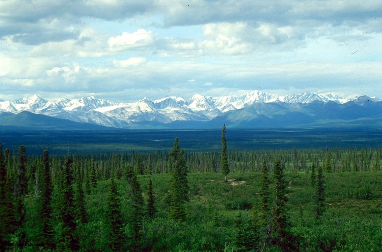
The Innuitian mountains are a mountain range located in Nunavut. It's an extremely remote mountainous area with very little vegetation, besides lichen and shrubs. Factors dictating this are the harsh climate and rocky landscape. The mountains are quite rigged and haven't been exposed to an immense amount of erosion, due to them being formed in the Mesozoic era, making them fairly young mountains compared to the Appalachian mountains.Mount Thor- Largest vertical drop in the world.

Great Lakes and St. Lawerence Lowlands
The Great lakes and St. Lawerence Lowlands are located in southern Ontario. The physical landscape is primarily flat with the exception of some hills. The region contains the best agricultural soil, which is great for farming, providing locals with fresh produce, and a large portion of the land has been developed or utilized in some way, making it a very urban area. Within the region are massive lakes and large bodies of water as well.A few popular activities are farming, water skiing, fishing, boating, going to the beach (sandbanks), and hiking.
Westren Cordillera
The Western Cordillera is located in British Columbia, Yukon, and covers a very small portion of Alberta.The mountains haven't been around long enough to be exposed to erosion, there for the mountains are still rigged and pointed.Some physical characteristics of this region include; lakes, forests, agriculture, interior plains (fields), and being quite mountainous.Human activities: kayaking/canoeing, surfing, vineyards, hiking, rock climbing, skiing/snowboarding, mining, forestry, etc. (The land contains a vast variety of minerals, providing the region with a large mining industry.)
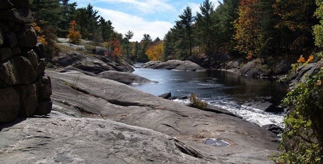
Appalachian Mountains
The Appalachian mountains cover the province of Newfoundland and Labrador, New Brunswick, Nova Scotia, prince Edward Island, and a portion of eastern Quebec.These mountains are a lot smoother, and flat, from being eroded. They where formed in the Palozoic era, exposing them to a lot more erosion than the innuitian mountains.Characteristics: mountainous, dense forests, hills, natural harbours, and is a highland region.Human activities: Paddling, rafting, kayaking, hiking, mountain biking, and fishing.
Canadian Shield
The Canadian Shield is the oldest and largest landform region.The ice age altered the physical appearance and formed the lakes, rivers, and any large bodies of water found within that area.It's a rugged, rocky, densely forested (coniferous trees) landscape with many lakes and rivers.Human activities include; cross country skiing, boating, hiking, and dogsledding.
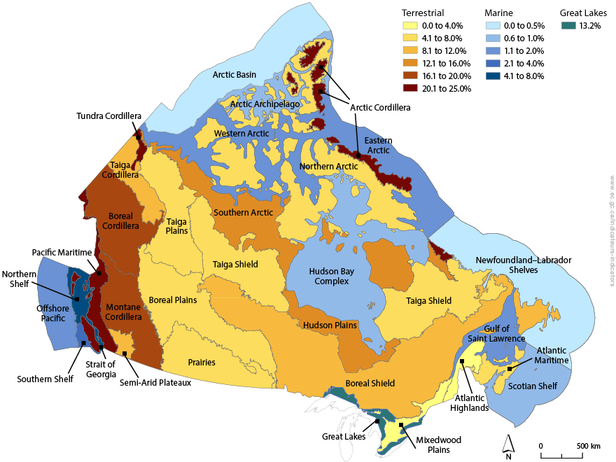
Canada's Ecozones
Definition:An Ecozone is an area of the Earths surface that has unique combinations of plants, organisms, animals, landforms and similar factors that portray to that certain area. (specific temperatures/climate, certain resources or visual aspects of an area)If you overlay various maps of Canada regarding different aspects of the Country (landform regions, climate regions, flora and fauna, etc.) you can see patterns, that display terrestrial ecozones and national parks of Canada.The concept of Ecozones was created in 1986.There are 15 terrestrial ecozones and 5 marine ecozones, and each have an area of at least 200,000km2.
Terrestrial Ecozones
Terrestrial Ecozones are land based ecozones. There are 15 in total across Canada, such as:Pacific Maritime Semi-Arid PlateauxMontane CordilleraBoreal Cordillera Taiga CordilleraArctic CordilleraNorthern Arctic Southern Arctic Taiga Plains Taiga Shield Boreal PlainsPrairiesHudson Plains Boreal Shield Mixed Wood Plains Atlantic Highlands Atlantic Maritime
Marine Ecozones
Marine ecozones are water based ecozones, with marine organisms and wildlife. There are 5 Marine ecozones in Canada.They include:Pacific Marine Arctic Basin MarineArctic Archipelago Marine Northwest Atlantic Marine Atlantic Marine
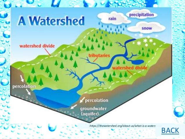
Water sheds
Water sheds are defined as; varying amounts of water coming from different locations, that join together, which filter into the same place. (Rivers, lakes, streams, melted snow/ice and rain fall.)Example: Water from, snow, ice, precipitation, and streams, that flow into the Arctic Ocean are a part of the Arctic Ocean water shed.
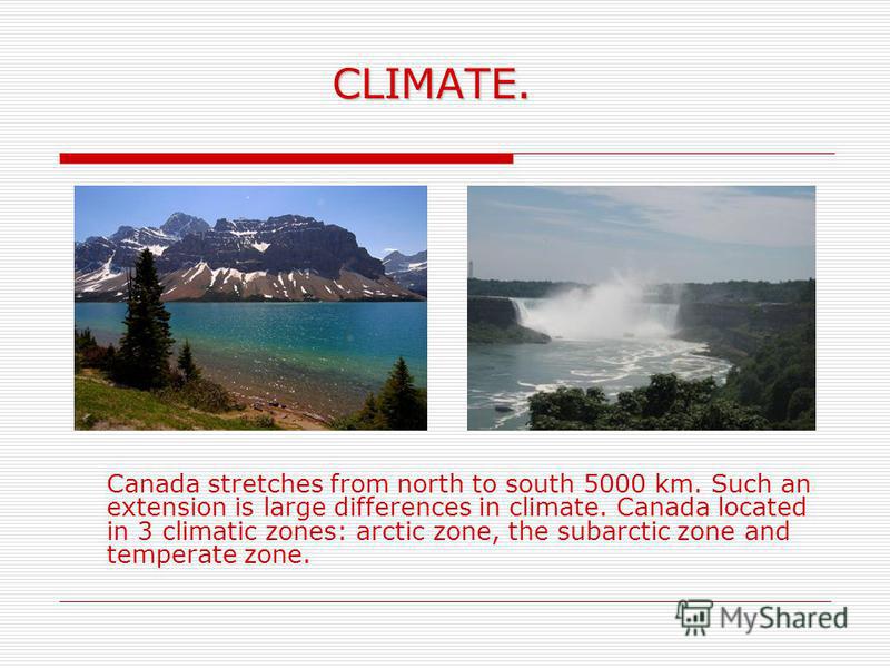
Canada's Climate
Climate is the long term patterns of temperature and precipitation.There are 8 climate regions in Canada:1) Pacific Maritime Climate Region (Maritime climate)2) Cordilleran Climate Region (Continental climate)3) Prairie Climate Region (Continental climate)4) Boreal Climate Region (Subarctic climate)5) Taiga Climate Region (Subarctic climate)6) Arctic Climate Region (Subarctic climate)7) South-Eastern Climate Region (Continental climate)8) Atlantic Maritime Climate Regions (Maritime climate)Article summary The article regarding the change in climate across Canada, especially in northern regions, affects on the sustainability of Arctic and boreal bird populations. It states that if the average global temperatures increase by 3 C above preindustrial times (A time when there wasn't tools or any technology to assist or completetasks) the birds will lose a massive amount of their habitats, which will rapidly decline their populations. Those birds have specific habitats for a reason, they can't just adapt to another habitat, because it's very likely that it would push them outside their tolerance ranges, also leading to the decline in their population.
LOWERN-Acronym
The acronym LOWERN stands for all the main factors that affect Canada's climate.L - LatitudeO - Ocean CurrentW - Wind DirectionE -ElevationR - ReliefN - Near Water
Latitude
Latitude:The further you are away from the equator, the colder it becomes. (Angles of the sun.)
Ocean Currents
Ocean Currents:A warm ocean current brings moisture and warms nearby land. Example: Pacific Ocean off British Columbia.Cool ocean currents cannot hold as much moisture as warm currents. Cooling nearby land Example: Atlantic Ocean off Labrador.
Wind direction
Wind Direction: Air over water collects moisture, over land air rises and cools, moisture falls back to Earth as rain or snow. Canada's prevailing wind (wind patterns) goes from the west to east.
Elevation
Elevation:Higher you are (higher the altitude) the cooler the air temperature becomes. (Air is thinner and cooler.)
Relief
Relief:The differences in elevation of land. Air cools, condenses and falls back into the leeward side where it is dry.
Near water
Near Water:Water warms and cools slower than nearby land.Water in summer, is cooler than land and air temperatures.Water in summer, is cooler than land and air temperatures. The cool air cools the nearby land. Durning winter water warms nearby land. Creating a moderating affect on temperature, for coastal areas.When living away from land you have a greater temperature range, ultimately imposing harsher temperature conditions during summer and winter.
Weather
Weather is the day to day readings of temperature and precipitation. (Wind speed, barometric pressure, and several other factors.)
Continental Climate
Continental Climate:Areas far from the oceans and lakes in the interior of land masses, have much greater temperature ranges because there is no large body of water to moderate the varying temperatures during different seasons.
Maritime Climate
Maritime Climate:On or Near larger bodies water (coastal areas) the temperature range is relatively small and the level of precipitation is higher.Because the oceans or lakes moderate the temperatures, so there isn't extremely cold, dry winters or humid, dry summers. Instead in summer the oceans filter cool air toward land and in winter warm air comes off the water.
Precipitation
precipitation is when certain amount of rain, snow, or hail is falling from the sky to the ground.Three types of precipitation:1) Relief (orographic) precipitation 2) Convectional precipitation3) Cyclonic precipitation

Plate Tectonics
Plate tectonics was a theory developed by Alfred Wegener, to show there was more beyond the Earths crust, a series of plates that have the ability to shift and cause a disturbance on the Earth's surface.

Plate tectonic process
The different movements of plates.
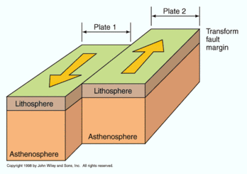
Transform
Transform Plate Boundray:Plates that move in different directions.
Convergent
Divergent Plate Boundray:Plates that move apart from one another.

Divergent
Converging Plate Boundary:When two plates move toward each other, that can push together and create a chain of mountains, one plate tends to get moved under the other in a subduction zone.
Richter Scale
A Richter scale is a device used to measure the amount of energy released by a certain Earthquake. The scale is usually from 0 to 9.2.9 and under, cannot be detected by human senses.3.0 to 3.9, can be felt by a few people in the area. However, damage isn't the outcome.4.0 to 4.9 can be felt by everyone in the area, minor objects broken.5.0 to 5.9 can cause damage to a few structures, depending on the strength of the buildings and where the earthquake strikes. 6.0 to 6.9 is a fairly strong earthquake, usually quite a bit of damage to infranstructure in heavly populated areas.7.0 . to 7.9 is serious damage to an area can even lead to the loss of life.8.0 and higher is catistrophic damage, to buildings and loss of life.
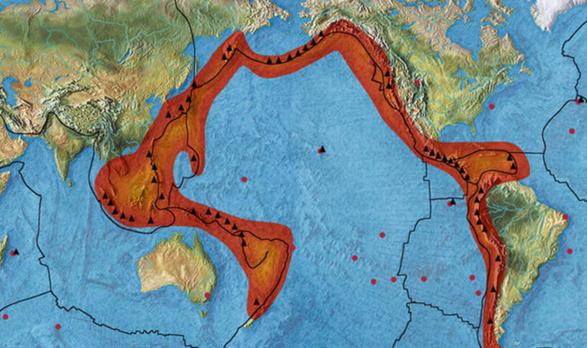
Ring of Fire
The Ring of Fire is where the most volcanic eruptions and earthquakes occur, due do the subduction of oceanic plates that where forced under lighter plates. Located in the Pacific Ocean.
Earthquakes
Definition of Earthquake:Shaking deep within the ground (hypocenter), and depending on the extent of the energy released, there can be severe destruction on the earth's surface. Caused by shifting or specific movements of plates.
How to Prepare?
You don't really have any warnings regarding the occurrence of an Earthquake, so its highly recommended that if you live in an area where earthquakes are more prone to happen you should have a bin of everything you could need to help you or potentially someone else survive through and after an Earthquake. Depending on the extent of the earthquake and your situation you could be without power and access to any resources outside your home for days.A few items that are necessary or that should be considered are:A first aid kitBlanketFlashlightBatterieshelmetroperain jacketradiomedicationmulti toollighter
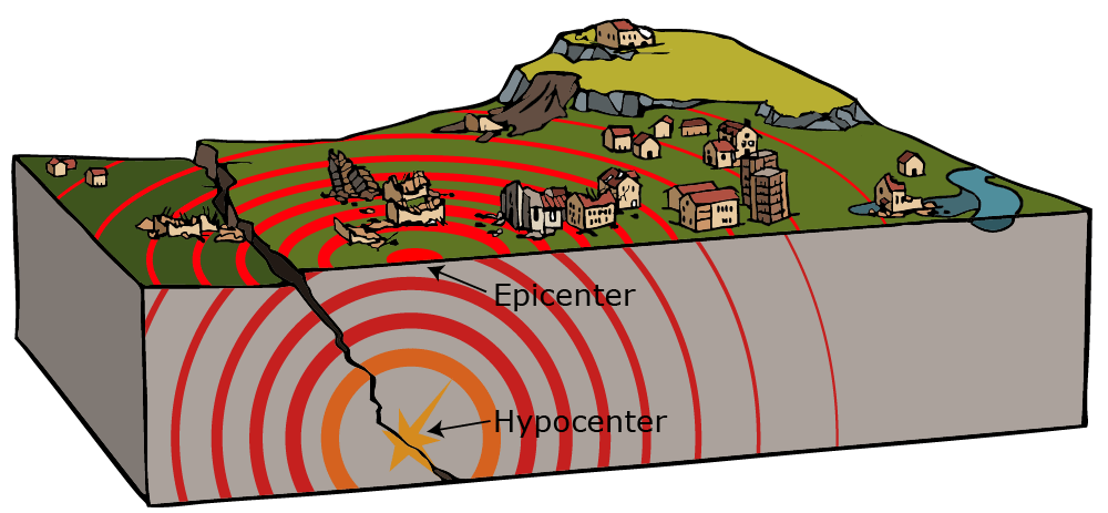
Hypocenter
The hypocenter is deep in the ground where the Earthquake acually occurs.

Epicenter
Epicenter is located on the Earth's surface directly above the hypocenter.
Tsunamis
A Tsunami is a large wave generated by; an Earthquake, landslide, or another major disturbance, that heads toward and flows inland. causing severe destruction and possibly loss of life. There are two primary types of Tsunamis; mega thrust Tsunamis or landslide Tsunamis.
Mega thrust Tsunamis
Mega thrust Tsunamis are when large Earthquakes occur, usually in a subduction zone do to a plate being forced under another during converging plate movements.
Landslide Tsunamis
Landslide Tsunamis are when a fast pace, heavy landslide falls into a large body of water and displaces it causing a disruption in the water, allowing a massive wave to form.

Canada's Flora
Canada has a vast variety of vegetation, due to its ability to accommodate vegetation/autotroph requirements (need certain concentrations of abiotic factors to survive.) Throughout Canada there's 7 different vegetation zones, providing different plant organisms and species with specific climate, soil richness and landforms distinct to that zone. Ultimately making the scenery and vegetation unique and diverse in many regions across Canada.Canada has 7 vegetation zones they include; tundra, west coast forest, cordilleran vegetation, boreal forests, grasslands, parklands, mixed forests, broad-leaved forests.Some of the vegetation that thrives in Canada include:Common eelgrassShowy OrchisSugar Maple treeNorthern Red Oak treePaper Birch treeLodgepole Pine treeBarleyArticle summaryThe article on the websitehttps://www.britannica.com/place/Canada/Soils-and-plant-and-animal-lifeGoes in-depth on the different vegetation regions in Canada and how they support different ecosystems and organisms living throughout them. It also explains the characteristics and features of the areas and what wildlife inhabits them. The article on vegetation regions in Canada
a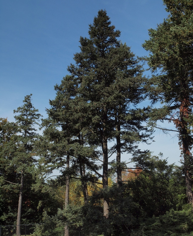
Interior Douglas Fir-Westren Cordillera

Barley-Interior Plains
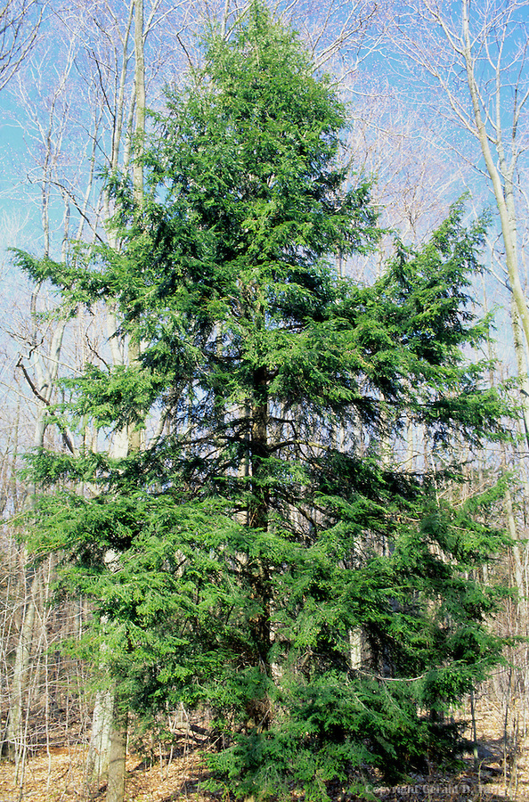
Eastern hemlock tree-Canadian Shield
Chestnut oak-Appalachian Mountains
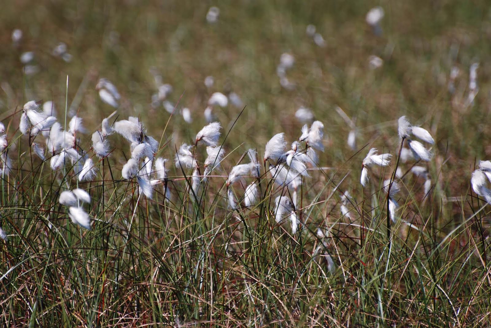
Cotton grass-Arctic Lowlands
Lichens-Innuitian Mountains
Maple Trees-Great lakes and St. Lawerence Lowlands

Canada's Fauna (by Land-form Region)
Canada's Fauna is very diverse due to the varying ecozones across Canada, that are inhabited by several species.Climate, food sources, proximity to water or other resources are major factors, that ultimately dictate where a specie can live. Fortunately Canada has several climate zones, vegetation zones, terrestrial and aquatic ecozones throughout the country allowing various species to live here, making different regions very diverse depending on what they offer.A few species that can be found in Canada are;Polar bearsmooseBeaversCariboudifferent species of deerWolverinesGray wolvesRainbow troutRockbassBald EagleHumpback Whales

Moose-Canadian Shield
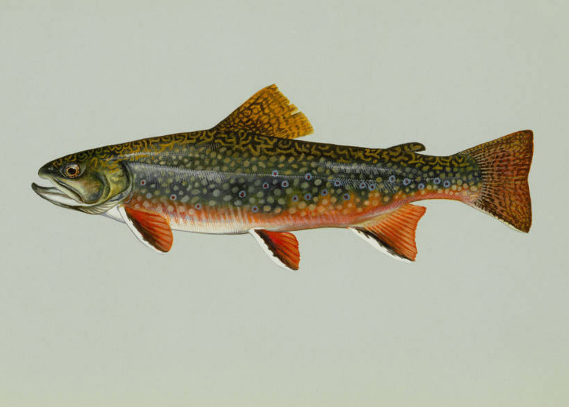
Appalachian Brook Trout-Appalachian Mountains
Gyrfalcon-Western Cordillera
Caribou-Innuitian Mountain
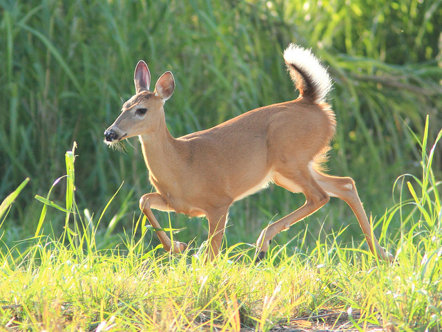
White-tailed deer-Great lakes and St. Lawerence Lowlands
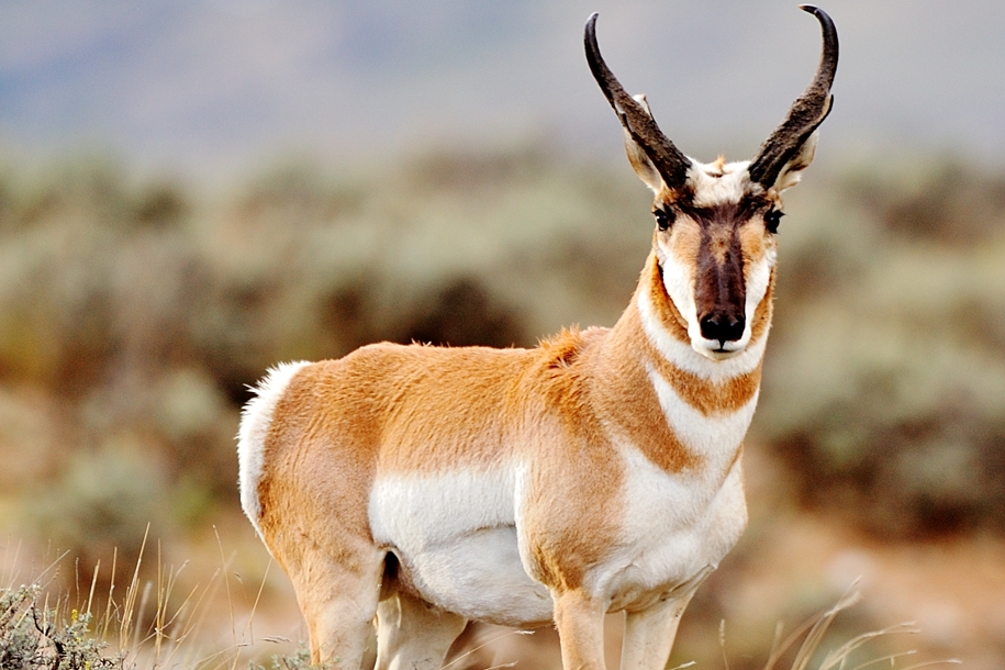
Pronghorn Antelopes-Interior Plains
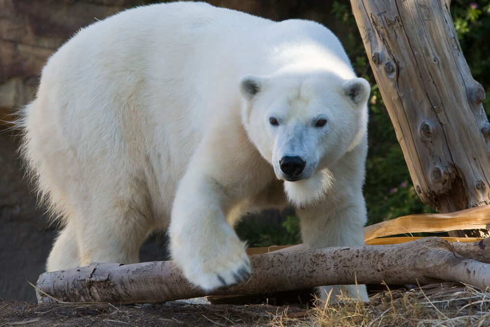
Polar bears-Arctic Lowlands

Canada's Tourism Industry
https://www.cbc.ca/news/canada/travel-canada-numbers-1.4682484In summary the CBC news article by Roberto Rocha, explains why, and provides statistics about the recent growth in the tourism industry in Canada. It focuses a lot on the growth in people traveling from foreign/international countries to Canada. In 2018, the recent increase in tourists from China traveling to Canada, resulted in China being the second largest origin for tourists traveling to Canada. The majority arrived in Canada for business, holidays/vacations, and in larger cities like Toronto there are large Chinese communities, and visiting family.
aFacts
Facts about Canada's Tourism IndustryRoughly $1.7 million jobs associated with the tourism industry.Niagara Falls, is the most visited attraction in Canada.In 2012, roughly 16 million international tourists visited Canada, making over 17.4 billion dollars.Ontario, Quebec, and Alberta are the most frequently visited provinces in Canada, by tourists.In 2018, 18.6 million international tourists visited Canada, Setting a new record. (January-October)Popular activities in Canada for tourists include; the Polar bear safari, kayaking/canoeing, whale watching, skiing/snowboarding, CN Tower edge walk.